Tuesday, July 21, 2009

Eldorado Peak - West Arete

Michelle and I tried this route two years ago with Jim and Marlene but weather fowled our plans. Link to 2007 trip report. With weather forecasts calling for high nineties in Leavenworth and clear sunny skies, we knew this would be the weekend to try it again. The West Arete is a very aesthetic rock ridge that rises nearly 3,000 feet at the head of the Marble Creek cirque near Cascade Pass. The peak and the route are prominently visible from the town of Rockport on Highway 20.

Eldorado (8,876 feet) is the highest peak on the right, Early Morning Spire and Dorado Needle on the left. Mt. Torment is just visible to the right of Eldorado.

A crappy zoom showing the approach from Dorado Needle Col and the route:

We drove up to Marblemount Friday evening, got our permits, and slept at the trail head. The next morning we got a pretty early start in order to beat the heat.

Hiking up the trail with Johannesburg Mountain behind:

Crossing the Eldorado Glacier:

The approach is about 5,300 feet of elevation gain straight up the south side of the massif. We got to the bivi sites (~7,500 feet) on the East Ridge of Eldorado before noon and spent a lazy day relaxing in the sunshine.

Our view to the east out our tent door:

The view of Forbidden Peak never gets old:


The next morning we we got another early start and crossed the Inspiration Glacier to the Mcallister Glacier, descended through the Dorado Needle Col and traversed and descended to the base of the route at around 6,000 feet.

Michelle crossing the Inspiration Glacier:

The Northeast Face of Eldorado. The East Ridge, our descent route, is the left hand skyline:

A beautiful sunrise and Hozomeen in the distance:

Michelle with Glacier Peak in the distance:

Also going to do the route were our new friends Josh and Phil. We ended up climbing most of the route together, which was a lot of fun as we shared the route-finding and loose rocks.

Michelle traversing the final glacier to the base of the route:

We easily gained the rock from just a couple hundred feet above the toe of the ridge on the north side and started simul-climbing up easy but loose rock.

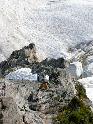
In places the ridge was quite thin and robustly alpine.


Phil and Josh leading on the ridge crest:

Michelle climbing around another cool feature:


We found the route description in both guidebooks we were using to be incredibly inaccurate and sand-bagged. We got off-route a couple times, but eventually found the elusive downclimb traverse and famed chimney move that seemed so key in the guidebook. Well, it wasn't much of a chimney and the downclimb was really short, but fun anyways.

Josh leading through the "chimney":

Michelle coming around the first gendarme:

Looking back at the first gendarme:

From here the route description was heinously wrong, but at least the route-finding got easier.

Interesting and technical climbing ensued:


At 3/4 height on the route, the unexpected came upon us as we donned boots, crampons, and ice axes again to climb and traverse a couple steep snow faces and a cool knife-edge ridge:

Finally, the last 600 feet or so was easier ground and we cruised to the top. We last talked to Josh at the base of this last step - then they put it into overdrive and ran to the top and down because the still had to hike out that night. We were taking it easy as we were planning another night out.


We topped out in the early evening - perfectly clear and windless:


Our last climb Mt. Goode on the left and Buckner and Forbidden on the right:

And an easy descent down the back side:


Our original plan had been to go to Dorado Needle as well, but we realized during the climb that our rope had somehow been severely damaged which was a great excuse to be lazy, sleep in and have a leisurley descent.

We watched a climbing class play on the glacier:


This guy played around here for a long time - not sure he knew what was under him:


We hightailed it out of there.


All in all a great 3 days in the mountains!


Saturday, July 4, 2009

Mt. Goode - East Buttress

Sometime during a random Skype conversation, the idea of climbing Mt. Goode was hatched between JR, O and Joe.

We decided the Beaver was the best way to access the peak.

(Just kidding) We took the boat...

Arriving in Stehikin on the Lady of the Lake, we disembarked and boarded the NPS shuttle which took us 10 miles up the road.

From here we hopped on our mountain bikes an started peddling, hoping to get 5 miles up the trail.

What we thought was going to be just a simple washout and then good road again, turned into over a mile of severely damaged road to no sign of a road whatsoever. We carried our bikes across the first section, it seemed easy enough....

A little waterfall:

and some boulder hopping with a bike - no problem!

We gave up on the bikes when we needed to use both hands for the boulder problems.


O making the moves...

We got back on good trail and made good time as we hiked another 10 miles to the base of the mountain.


The brush cleared and opened to moraine and we got a great view of the route.

The northeast face of Mt. Goode (center peak) and Storm King Mountain on the right:

Below is the line we took. Once off the glacier and on the rock, the route is 2,800 feet of rock climbing. It is mostly very easy 3rd and 4th class climbing, with a few pitches of mid-to-low fifth class. But given the ease of climbing, it is still a huge objective on a remote alpine face.

But before we reached the base of the climb, we still had to cross the North Fork of Bridge Creek and bushwack the way to our bivy site at 5,400 ft, reaching there just before dark.

Michelle emerging from the jungle:

The next morning we got a 5 oclock start and headed up.

The glacier was pretty easy to navigate and we quickly made our way to the base of the buttress toe, accessing it on its left side.

The weather was perfect!

We found a perfect bridge of snow, accessed the rock, changed shoes and started cruising up the rock.

The route was clean and easy to travel and we quickly moved up the route.

up and up.....

Looking back down the route...

We topped out around 2 p.m. The weather was perfect!

From left to right; Sahale, Logan, Forbidden and Eldorado peaks

More views of the Cascades from the top...

and more...

John, Olivia, crooked hat and Joe... on the summit

Now the hard part.....THE DESCENT.... (JP says not so hard:)

We went down

and down

and rested. This isn't even close to being over....

Lucky for us, Olivia had been carefully picking out the descent route which did not involve any heinous bushwacking.


It was all smooth sailing through old avalanche paths and meadows.


The view was great

Looking back at the west face of Goode:

We finally made it back to that waterfall. Michelle got vertigo and John assisted her with her bike.

All was going well, we retrieved our bikes hit the road and started back to Stehikin, but then our first big problem. Joe was expertly handling his less than perfect mountain bike down the bumpy terrain when the stem of his tube broke off leaving him flat. This would not have been much of a problem, given we had an extra. But the bicycle pump that we had carried up and over Goode, did not have a nozzle and could not be used. We were stuck, just 1/2 hour from fresh coffee cake and fresh coffee at the bakery with a bunk bike.

JR and O rode on and said see you there. Luckily Michelle was clearly thinking and assured Joe that there would be a pump at the Ranch if we just waited for the shuttle another 10 minutes. We were picked up, pumped up and back on the road. We made it to the Bakery just 15 minutes after JR and O!

Relaxing with some Joe's at the Stehikin Bakery!

We made quick work of the last mile, boarded the fast boat and headed home; but not before jumping in Lake Chelan for a quick swim!